Midterhuken
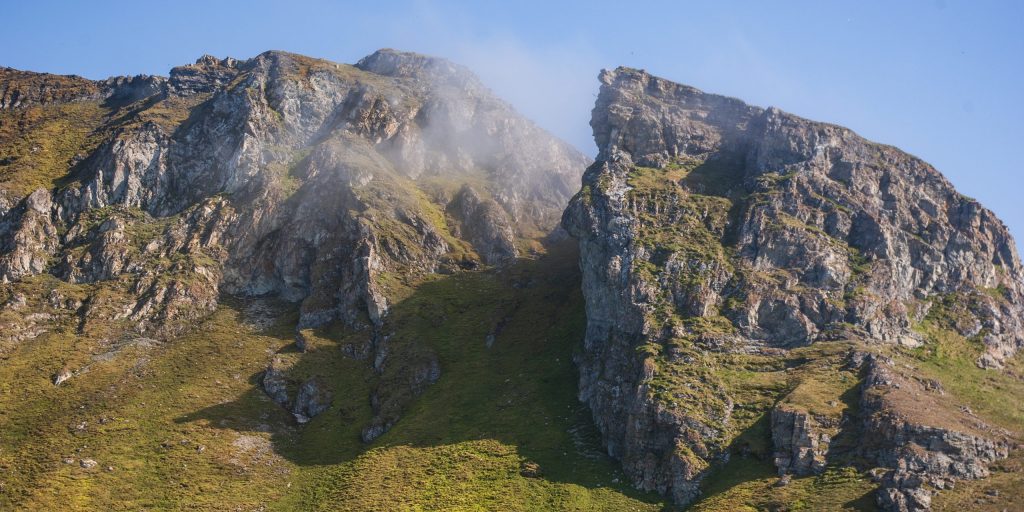
The tundra ecosystem is generally nutrient limited, but seabirds may introduce large amounts of marine‐derived nutrients to land in their breeding locations. The guano is rich in nitrogen, phosphorus, and other elements, which strongly fertilize these areas and influence the spatial distribution of plants along nutrient gradients. The nutrient concentration very close to the cliff can be so high that it is toxic, and no vascular plants are growing there.
Blomstrandhalvøya
Blomstrandhalvøya is dominated by marble, producing calcareous and alkaline substrate. This is clearly reflected in the vegetation. The Dry exposed calcareous ridges are dominated by Carex nardina, together with Dryas octopetala in less exposed ridges. In open areas with somewhat more moisture, Saxifraga aizoides may turn up, and in more sheltered heaths and mossy meadows we find Salix reticulata; both species that avoid acidic substrate. The smaller lakes are surrounded by moss tundra, fertilized be geese utilizing these areas.
Leinstranda

Above the shoreline, the area is dominated by raised beaches and thus marine sediments, partly disturbed by fluvial and periglacial activity. Silene acaulis is a common species on these marine deposits. Moving towards the slopes, disturbance by solifluction is evident. Arenaria humifusa, one of Svalbard’s rare and red-listed species can be found here, in disturbed gravel or disturbed soils along solifluction lobes. Arenaria humifusa is an extremely weak competitor, and dependent on disturbance. The area is dominated by mesic tundra characterized by Luzula nivalis, suggesting circumneutral or alkaline soil conditions. The presence of Salix reticulata and Arenaria pseudofrigida is supporting this. Engelskbukta is known as a sheltered bay, and in the slopes with southern exposure, we find elements of vegetation more common in warmer inner-fjord areas, like developed Cassiope heath.
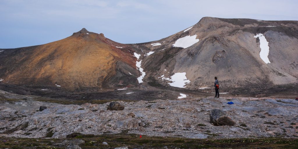
Calypsostranda
This area shows several unstable habitats, strongly influenced by glacial- and periglacial processes. The vegetation is in different states of succession. Above the seashore, the raised beach plane is strongly influenced by marine sediments; an environment where Silene acaulis is thriving. Moving towards Renardbreen, one enter an area with well- developed polygons, before approaching the outer moraine of Renardbreen. This moraine was deposited under the last major glacial advance in 1880. Towards the glacier there is a clear pattern of primary succession; the number of species decreases when the substrate gets younger. The alkaline substrate in combination with high levels of disturbance create a nice habitat for Puccinellia vahliana.
Hemsedalen
Ekmanfjordan is part of the inner fjord system of Isfjorden, and some of the warmest and driest areas in Svalbard. Along the river Hemsli, the south facing slopes are sheltered, and a lush vegetation has developed. Dry grassy heaths and meadows, slopes with stable and luxuriant vegetation cover, and well-developed moss tundra in moist areas. Here you find thermophilous species like Arnica angustifolia and Petasites frigidus. The entrance of Hemsedalen is dominated by vegetated mesic planes and slopes with dense Cassiope heath, which is characteristic for bioclimatic zone C. In the moist areas there are low hummocks of moss tundra with Rubus chamaemorus. Rubus chamaemorus had a much larger distribution in Svalbard in early Holocene (6-8 K years BP), when the mean temperature was warmer than today.Towards the seashore there is a clear shift, from vegetated plains to sparsely vegetated moraine deposited by Sefströmbreen when it surged in 1886
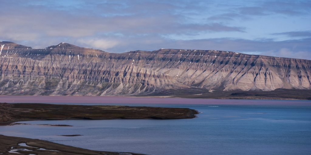
Kapp Nathorst

Dicksonfjorden is part of the inner fjord system of Isfjorden, and some of the warmest and driest areas in Svalbard. The mountains surrounding the inner part of Dicksonfjorden consist of red Devonian sandstone. The red colour is characteristic for Devonian deposits and indicate alkaline substrate. Towards the drier ridges and scree slopes, Dryas octopetala is dominating, whereas Cassiope heath is dominating in areas with some snow cover in the south facing slopes and mesic plains at the entrance of Nathorstdalen. Here you also find rare, thermophilus species like Tofieldia pusilla. Moving towards the sea, we find Potentilla pulchella on open fluvial, substrates This species is confined to circumneutral or alkaline soil. The cape is influenced of marine deposits, and here we find a well-developed salt marsh community. A zonation of species is created according to the level of sea water influence, with the halophytic grass Puccinellia phryganodes in the most saline areas, followed by Carex suspathacea and Stellaria humifusa.
Bohemanneset

The sediment plains of Bohemanflya and Bohemanneset is dominated by shallow mires, wet moss tundra and calcium-rich fens. Species like Dupontia fisheri and Eriophorum scheuchzeri are common in wetlands, and the yellow flowers of Saxifraga hirculus is dominating the wet moss tundra, with Dryas octopetala on drier ridges and Silene acaulis on the mesic plains with marine deposits. The rare and red-listed species Coptidium pallasii can be found in the calcium-rich fens. The Svalbard populations are the only ones in NW Europe and by far the northernmost ones known in the world.
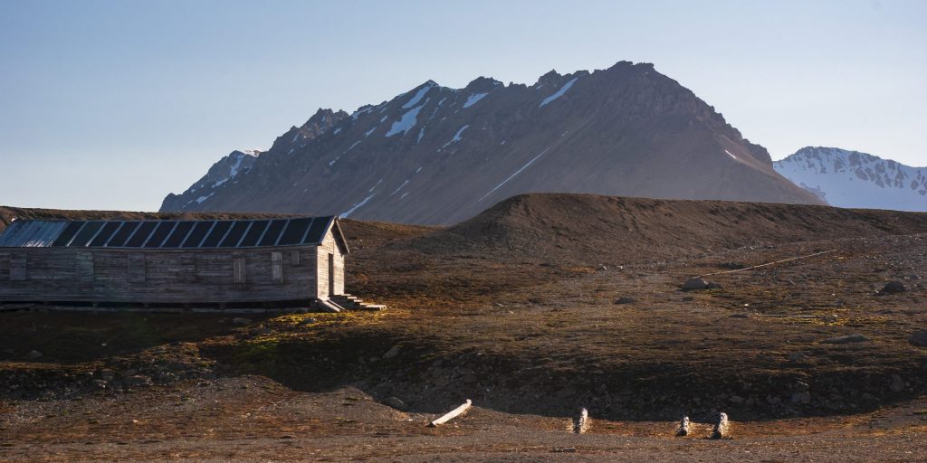
Trygghamna

About 60% of Svalbard is covered by glaciers, whereof many had a much larger extent about 100-150 years ago. Thus, recently deglaciated soils and unstable substrate are common. At the western shore of Trygghamna, large areas are covered by recent glacial deposits, colonized by pioneer species with high tolerance for disturbance. Periglacial processes like polygon structures increase the instability and heterogeneity further, creating micro-environmental differences in snow-distribution and grain-size. Outside the moraine area more developed and stabilized vegetation is present. Moss tundra has developed based on nutrient input from former human activity several centuries ago (whaling and Russian Pomors).
Text: Pernille B. Eidesen
Photo credit: Simen S. Hjelle, 2019